
Grain Management
Ag Tech’s grain management solutions give growers real-time control from bin to bushel. With OPI Blue monitoring, you can track grain quality, reduce loss, and protect every bushel with confidence.
Handheld monitoring
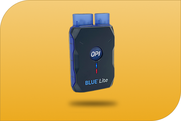
BLUE™ Lite
OPI Blue™ Lite makes checking your bins fast and easy. Just connect it and you’ll see real readings on temperature and moisture right where you stand—no waiting, no monthly fees. It’s a simple, reliable way to keep an eye on your grain and know what’s going on inside every bin.
Remote monitoring
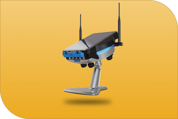
EPIQ™
With Epiq™ Remote Monitoring, you can check your bins anytime, anywhere. It sends real-time updates straight to your phone or computer, showing temperature and moisture changes as they happen. You’ll catch problems early, save on spoilage, and rest easy knowing your grain’s in good shape even when you’re off the farm.
Full Automation
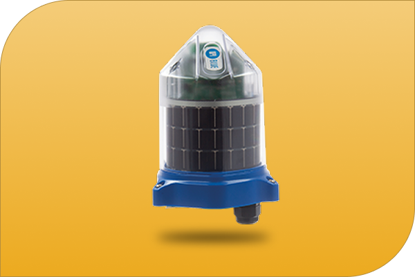
BLUE™
OPI Blue™ Full Automation does the work for you. It watches your bins around the clock and runs the fans automatically to keep your grain in top condition. No climbing, no guesswork—just steady, dependable control that helps protect your crop and your time.
Monitoring and Analysis
Ag Tech’s monitoring tools provide real-time insight into soil health, crop growth, and nutrient balance—using Nutriscan and Agremo technology to help growers make precise, data-driven decisions for stronger, healthier yields.

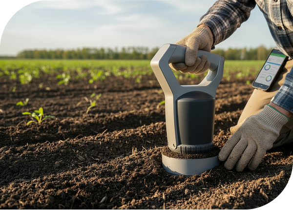
Nutriscan by ATP
NutriScan by ATP is a handheld soil, plant and forage analysis tool that delivers real-time nutrient data right in the field—no lab delays, no guesswork. Built on a database of over 21,000 verified soil samples, it measures key nutrients and organic carbon in just five minutes. Connected to your smartphone or laptop, NutriScan maps GPS-referenced samples for precise field management, helping farmers make faster, smarter fertilizer decisions and improve soil health—all from the palm of their hand.
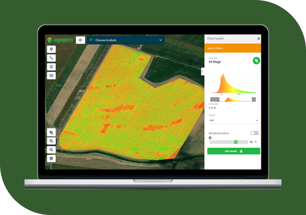

Aerial Imagery Analysis
Agremo helps farmers see exactly what’s happening in their fields using easy-to-read maps from drone or satellite images. With tools for crop monitoring, plant counting, and field trials, Agremo shows where your crops are thriving and where they need attention. From spotting nutrient issues to tracking emergence and yield potential, it gives you clear, reliable data to make better decisions, save on inputs, and boost productivity—all from one simple dashboard.